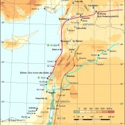
Levant: 53 Historical Maps Concerning the Western Campaigns of the Assyrian Empire
Support for the Graphic Design of the Historical Maps
Ariel M. Bagg (Heidelberg)
With the dawn of the Assyrian expansion during the 8th cent. BCE the political independence of the Levant gradually declined. The aim of this research project on the western expansion the Assyrians was to investigate the Assyrian organization and administration of the Levant. A comprehensive explanation of the Neo-Assyrian toponymy served as a base for these investigations.
Thanks to the funding of the DPV, a series of 53 colored historical maps were generated to visualize all relevant information concerning the historical geography: toponyms with definable location (3 maps), Assyrian conceptions of the Levant (8 maps), bodies of waters and mountains with definable location (1 map), Western campaigns of Neo-Assyrian kings (30 maps), political geography of the Levant (5 maps). The maps are based on an expanded map of the Near East by Kurt Franz, which was prepared by Martin Grosch. The professional graphic design of all 53 maps was funded by the DPV. It was conducted by Christoph Forster (datalino, Berlin) based on drafts by Ariel Bagg.
Further Information
Weitere durch den Verein geförderte Projekte
Dieser Beitrag ist auch verfügbar in: German


